The basic units of the public land survey are six-mile square townships that are further subdivided into one-mile square sections. Just as on a sheet of graph paper, the townships are regularly arranged across the state. The sections are further regularly arranged within the townships.
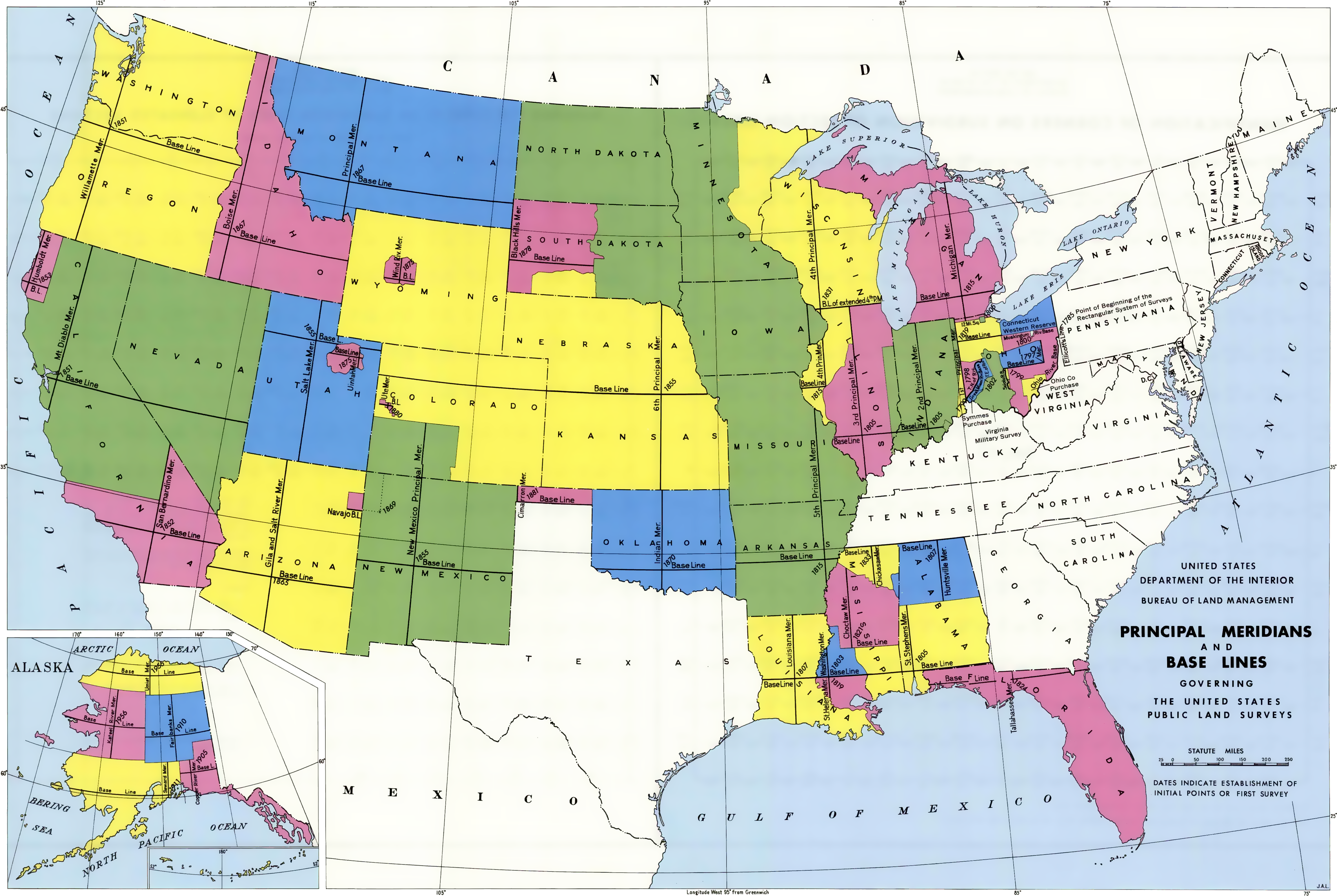
The starting point of the public land survey in Wisconsin is located on the Wisconsin - Illinois border about 10 miles east of the Mississippi. This point, known as the initial point, marks the intersection of the baseline, which is also the southern state boundary, and the principal meridian, which is a line that runs due north from the initial point. In Wisconsin, this line is known as the Fourth Principal Meridian. This line is an extension of the Fourth Principal in Illinois that has an initial point is in the west-central part of that state. The numbering of the townships in Wisconsin, however, is separate from the numbering in Illinois.
The east-west lines that cross the principal meridian every six miles are known as township lines. The north-south lines that intersect the baseline every six miles are known as range lines. The six-mile square block of land between the adjacent township lines and the two adjacent range lines is called a township.
Each township is numbered based on how far north it is located from the baseline, and how far east or west it is located from the principal meridian. For example, the city of Madison is in a township that is seven townships north of the baseline and nine ranges east of the principal meridian, thus it is in what is known as Township 7 North, Range 9 East.
Within a six-mile square township are 36 one-mile square sections. These are numbered starting with number one in the northeastern corner of the township and then moving westward with sections number 2 through 6 along the northern edge of the township with section 6 in the northwest corner. Section 7 is immediately south of section 6 and the numbering moves eastward with section 12 immediately south of section 1. Section 13 is immediately south of section 12 and the numbering then progresses westward. This back and forth pattern is repeated until reaching section 36 in the southeast corner of the township.
A note on the word township: this word is used in several different ways in this text and in other land descriptions. First and foremost it describes a six-mile square area laid out as part of the Public Land Survey System, this is also known as a congressional township because the land surveys were originally directed by congressional action, this area can also be described as a survey township. These have a numerical description such as Township 7 North, Range 9 East. The word township is also used to describe a unit of local government, a civil township. Here the name is shortened to "town" such as the Town of Vermont, the Town of Rome, or the Town of Orion. While these civil townships often share the same geographic boundaries as a congressional township, sometimes they include larger or smaller areas. To confuse the issue even further, the word township is also used to describe the east - west line of six-mile square blocks between to adjacent township lines.